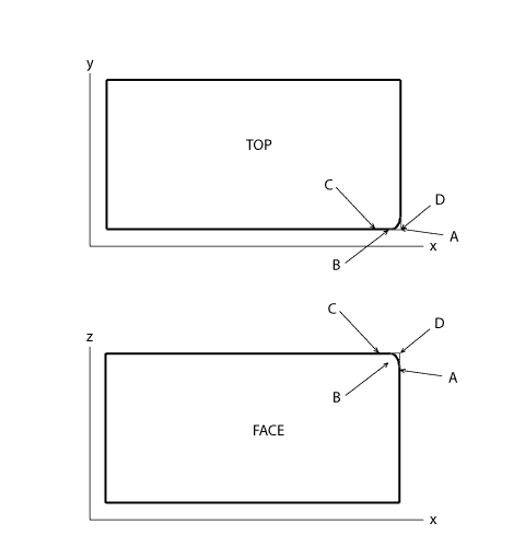
This approach -- using three coordinates, each taken from a point not at the corner -- requires that the x-axis for the grid system in use be parallel to the wall. The illustrations in Figure 2, A and B should help show why this is the case. The same block is shown from in front (below) and from the top (above). The same survey points are shown in each.
| Figure 2A. In version A the x-axis is parallel to the wall, and everything is as it should be. Each coordinate can be applied to the single 3D data point representing the corner of the block (D). |
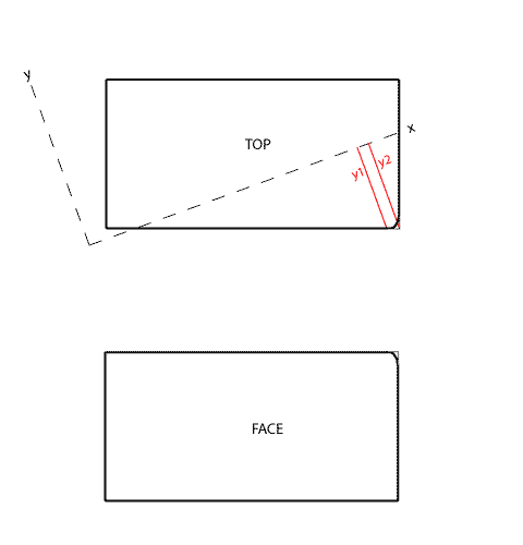
| Figure 2B. However, version B of the same block shows a different orientation of the x-axis; it is not parallel to the wall in this system. As a result, any y-value surveyed for point B is slightly different from the correct y-value for point D (as line y2 is slightly longer than y1 in Figure 2, B). The extent of the difference depends upon the angle of the x-axis relative to the face of the block and the distance of the surveyed point from the corner. | |